
Terra
Growing up in Big Sky Country, I’ve always felt a strong connection to the land and sky, and have long been fascinated by the interplay of light with the two . This fascination carry’s over wherever I find myself - Montana or elsewhere.

Golden hour at the Bells

Lake Irene
At 10,660 feet, in a basin just west of the Continental Divide in north Colorado's Rocky Mountain National Park, lies beautiful Lake Irene. The waters are generally calm, and often like glass, as they were on this late summer evening.

Bliss

23 Below
December in the Gallatin Valley of south central Montana, can be beautiful - and brutal.
I recall well the day I shot this. My son was with me on a winter drive, and the temperature was -23 F., with occasional winds of 10 mph, delivering a wind chill of -40 F.
Conversely, the temperature here can get to 90+ degrees F.
Not too far north of Yellowstone, from where the river originates, life goes on, and thrives, in these extremes.

Maroon Lake and Maroon Bells, early fall
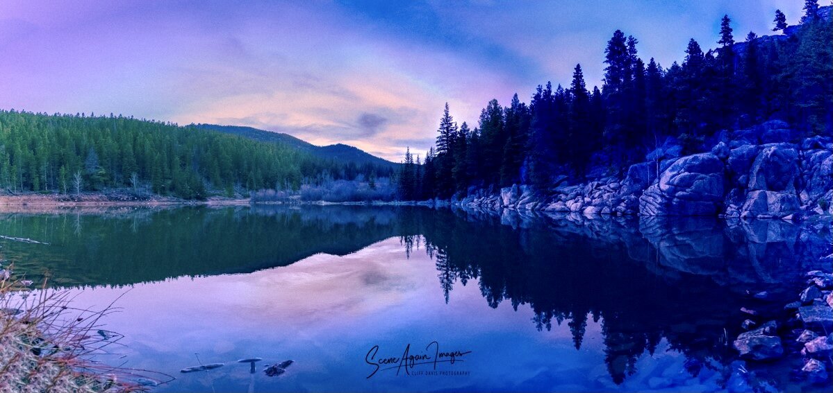
Golden Gate
I drove up nearly deserted mountain roads in the evening to Golden Gate State Park, in the front range of the Rockies, intent on arriving to this poorly named small lake (it’s called Dude Hole) to see what the sunset might look like.
Upon arriving, I realized that the gate to the road I wanted to take was not yet open for the season. I parked, and loaded up my gear, and hike down the road until I came to a fork in the road.
No cell phone service means that my location on the map was questionable. I hiked for approximately 1/2 mile on a trail, and then my cell service returned long enough to let me know that I was going wrong direction. I turned around and headed back along the trail, sure I was going to miss any hope of capturing the sunset.
When I arrived back at the Y, I traveled down a very steep grade, until I found a small side road, and followed this for another quarter mile, passing what’s left of an old homestead cabin, crossed the stream twice, and finally arrived at my destination.
I honestly didn’t think there was much left in the sky that would be impressive, but set my gear up anyway. As I finished leveling my tripod, I saw clouds to the west, past the head of the lake.
And then I waited. And as the sun sank deeper over the horizon, the sky was illuminated with white, blue and purple.
The air was calm and still.
And then this.
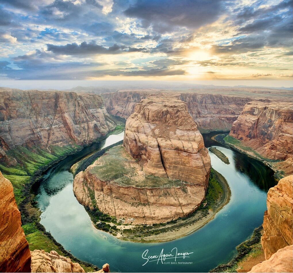
Horseshoe Bend, Northern Arizona

Antelope Canyon
Hasdeztwazi. Navajo for ‘Spiral Rock Arches.’ Arguably, even the native name doesn’t do it justice.
Antelope Canyon, a slot canyon on Navajo land east of Page in northern Arizona, packs incredible images and colors in a tight location.
This is truly a place one must see at least once in life, and is on many peoples bucket list.
I have no doubt that God is an artist at heart, and this is one of his prouder works.

Maroon Lake and Bells

Trail of the Cedars
The lush, wet valleys of western Glacier National Park are home to pockets of old-growth temperate rain forest composed of ancient Western Cedars and Western Hemlocks. Skunk cabbage, Lady Fern and other plants common to the Pacific coast form a carpet on the forest floor.

Lower Antelope Canyon
Rainwater, especially during monsoon season, runs into the extensive basin above the slot canyon sections, picking up speed and sand as it rushes into the narrow passageways. Over time, these passageways eroded away, making the canyon deeper and smoothing hard edges in such a way as to form characteristic "flowing" shapes in the rock.
These flash-floods can be productive; and deadly.
On August 12, 1997, 11 tourists were killed in lower Antelope Canyon by a flash-flood. A thunderstorm dumped substantial rain 7 miles upstream, and the result was a flash-flood here. As a result, one can now only visit with a native guide, tuned in to the latest weather, to prevent another tragedy such as this.
Like most wild places, it is uniquely beautiful, but can be a very unforgiving terrain. And those who’d venture here would have it no other way. It’s what stirs our hearts, and pushes us on.

Longs Peak
Neníisótoyóú'u (Arapaho). Longs Peak rises 9,000 ft. above the western edge of the Great Plains.
The 14,259 ft. peak lies inside Rocky Mountain National Park, in northern Colorado’s Front Range. It was named for the explorer Stephen Harriman Long.
Together, Mount Meeker (13,916 ft.) and Longs Peak form the Twin Peaks Massif. French trappers called the twin peaks Les Deux Oreilles, French for ‘two-ears.’

Woman in the Wind
Woman in the Wind, Lower Antelope Canyon, Arizona.
Sunlight filtering into the canyon from above produces an incredible array of color, light and shadow.
This and other slot canyons in the region were, and continue to be formed by the relentless forces of water in the form of flash-floods, as well as wind, carving and sculpting the Navajo sandstone.

Bowman Lake
What can be said about Bowman Lake, and Kintla Lake to the north, that God Himself hasn’t already proclaimed?
Lying on the remote western edge of Glacier National Park in northwestern Montana, Bowman Lake is a treasure.
Stunningly clear and clean glacier-fed waters, with visibility extending in places to 15-20 feet, and a show of sunlight playing off of the submerged rocks presents a glowing foreground to the awesome, rugged beauty of western Glacier Park. This is what wild really is.
And on the 8th day, God made Glacier. And He was pleased.

Castle Reef
Castle Reef rises above Wagner Basin on the north edge of Sun River canyon, as the river cuts its way eastward exiting the Rocky Mountains onto the plains of Montana.
The Sun River Canyon gives us pause, and reminds us that life is about discovery and adventure, and seeing all things as new. Even that which has preceded us by eons.

Clinton Gulch
Tucked high in the Ten Mile Range of the central Colorado Rockies, Wheeler Peak rises with the sun above Clinton Gulch.
An extension of the Mosquito Range, the Ten-Mile Range rises to nearly 13 thousand feet, the tops catching the first rays of sunlight sunrise as they have for millenia.

Upper Holter Lake
Dawn is glorious on Holter Lake, one of a chain of lakes in west central Montana, on the mighty Missouri River, just south of the Gates of the Mountains.
One morning, on my way to work in paradise…

Desert Storm
The northern Arizona desert is a fragile and complex ecosystem that presents itself in many and varied ways.
Like many places, one location can appear as a totally different place, depending upon the season and the weather.
The Mojave desert surrounding Page, Arizona is definitely one of these places.
Just northwest of town, this location often grabbed my attention in my time spent there.

Emigrant Peak
Emigrant Peak, on the western edge of the Absaroka Range, rising high above Chico Hot Springs, Paradise Valley and the Yellowstone River in south-central Montana.
Here, Paradise isn’t just a name.

Green Lake
Fog blankets Green Lake, on the northern portion of Colorado’s 11,670 foot Guanella Pass.

East Tunnel
The view from the East Tunnel on the Going to the Sun highway, below Logan Pass, looking east at Going to the Sun Mountain.
Built in 1931, the tunnel is 408 feet long. Before work was began, a 3.5 mile trail was constructed, 200 feet above the site.
6,250 cubic yards of rock and dirt was removed in order to construct the tunnel, one of the most difficult aspects of the work of constructing the east side of the Going to the Sun Road.
Like much of the park, the highway is a marvel, and a work in progress.

Going to the Sun Mountain
Going to the Sun Mountain rises dramatically over St. Mary Valley on the eastern side of Glacier National Park.
While hunting on Red Eagle Mountain with his Pikuni (Piegan) friend, Tail-Feathers-Coming-Over-the-Hill (James Willard Schultz) gave this mountain the name it bears today.
Tail Feathers said “it is a powerful and sacred name; I could have not named it better.”
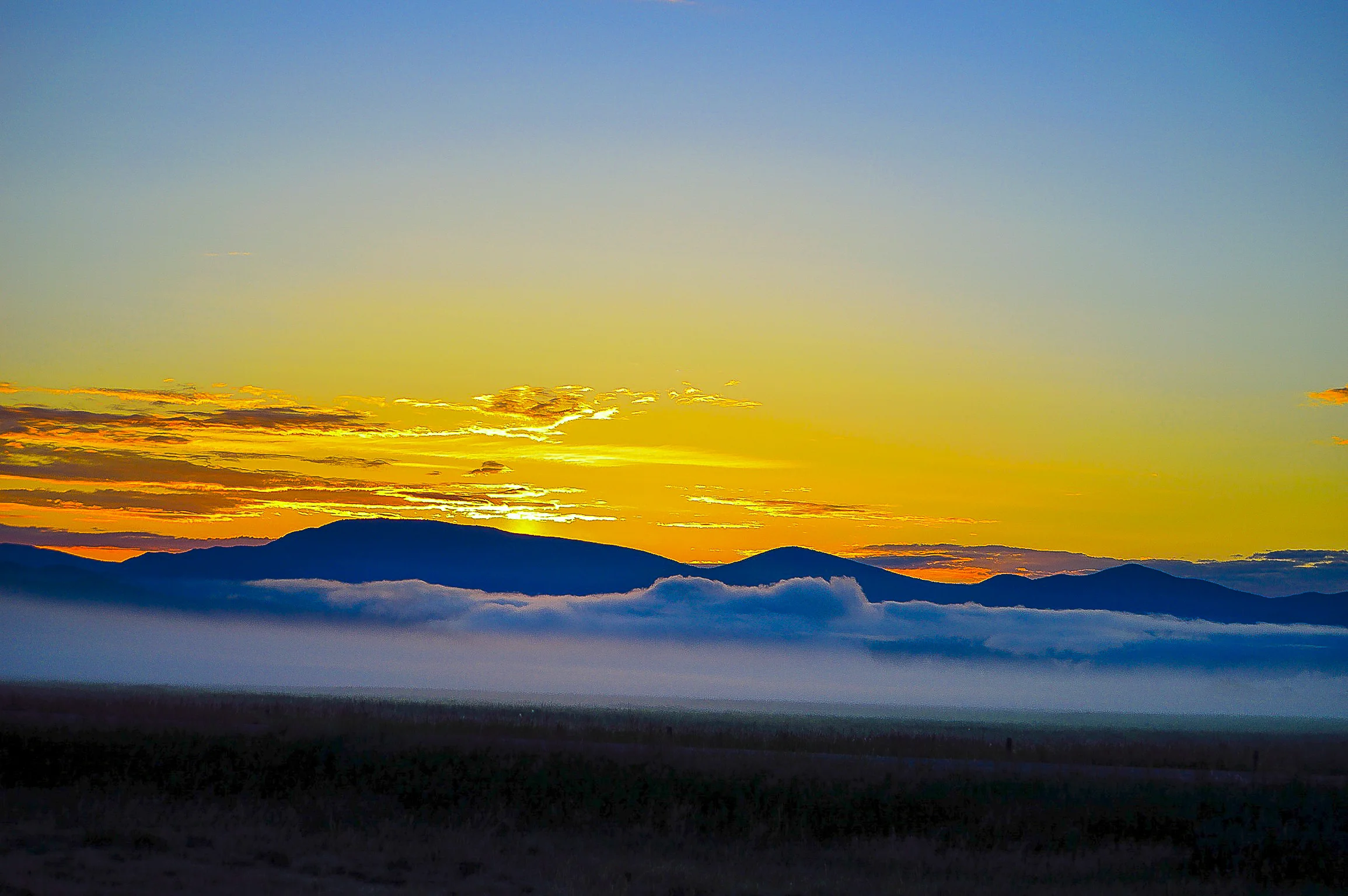
Helena Sunrise
An inversion layer in the north Helena Valley on an early spring morning. Looking east, the mountains grace the rising sun.

Grinnell Point
Grinnell Point towers over Swiftcurrent Lake and the Many Glacier Valley in remote, northeast Glacier National Parks Lewis Range. This sub-peak hides the main summit of Grinnell Peak from view.
The peak, and nearby Grinnell Glacier were named for George Bird Grinnell, an American naturalist, historian, anthropologist and writer, who visited the area in 1885, and was later instrumental in establishing Glacier National Park in 1910.

The Maroon Bells
Maroon Peak and North Maroon Peak, both over 14,000 feet above sea level, and separated by around 1/3 of a mile, rise over Maroon Lake, in the Elk Mountains of Colorado’s White River National Forest.

Maroon Lake and Bells
Ducks take advantage of a gorgeous warm fall day at 9585 feet, with the twin peaks rising behind Maroon Lake, looking west into the Maroon Bells-Snowmass Wilderness. In less than a month, snow will blanket the area.

Monumental
A cloudy March day lends amazing colors to an already impressive view of the East and West Mittens, and Merrick Butte, on the Navajo Reservation in Arizona, near the Utah border.
Tsé Biiʼ Ndzisgaii, Valley of the Rocks (Navajo), rise as high as a thousand feet above the valley floor. 50 million years of erosion of what was once a plateau have given us what is now here; what we now call Monument Valley.

Past Sunset
A 1940’s era DeSoto Custom sits off the Stearns-Augusta Road, Montana.

Sunset on the Front
A stunning sunset - in a land of stunning sunsets. Normally dark and silhouetted by the backlighting of the setting sun, the eastern front of the Rocky Mountains is highlighted by sunset and sunlight reflected off of clouds, south of Choteau, MT.

Sinopah
Sinopah Mountain, rises like a fortress over the Two Medicine Valley and Two Medicine Lake, in the Lewis Range of Montana’s Glacier National Park.
The name is Blackfeet Indian for ‘Kit Fox,’ who was the daughter of Blackfeet chief Lone Walker, and the wife of Hugh Monroe, an early fur trader who lived with the Pikuni’s (Blackfeet) and gave him the name Rising Wolf .

Hyalite
Rain clouds lift on a spring morning.
Hyalite Peak, Maid of the Mist Mountain, Palace Butte, Elephant Mountain and Mount Blackmore form the southwest wall of Upper Hyalite Canyon, in the Gallatin Range, south of Bozeman, MT.

Square Butte
This impressive butte made of uncommon Shokinite igneous rock, rises several hundred feet above the prairie in the Adel Mountain Volcanic Field, 22 miles due west of Great Falls, MT.
This intrusive laccolith was formed by volcanic activity about 75 million years ago, and shaped by eons of time and heavy erosion.
4o miles long and 20 miles wide, It has been an area landmark for as long as humans have inhabited the area, including me and my family.
I have very early memories of this sentinel rising above the prairie, when headed in the early morning hours to hunt and fish in the mountains south of this area.

Pine Valley Mountains
North of St. George, Utah.
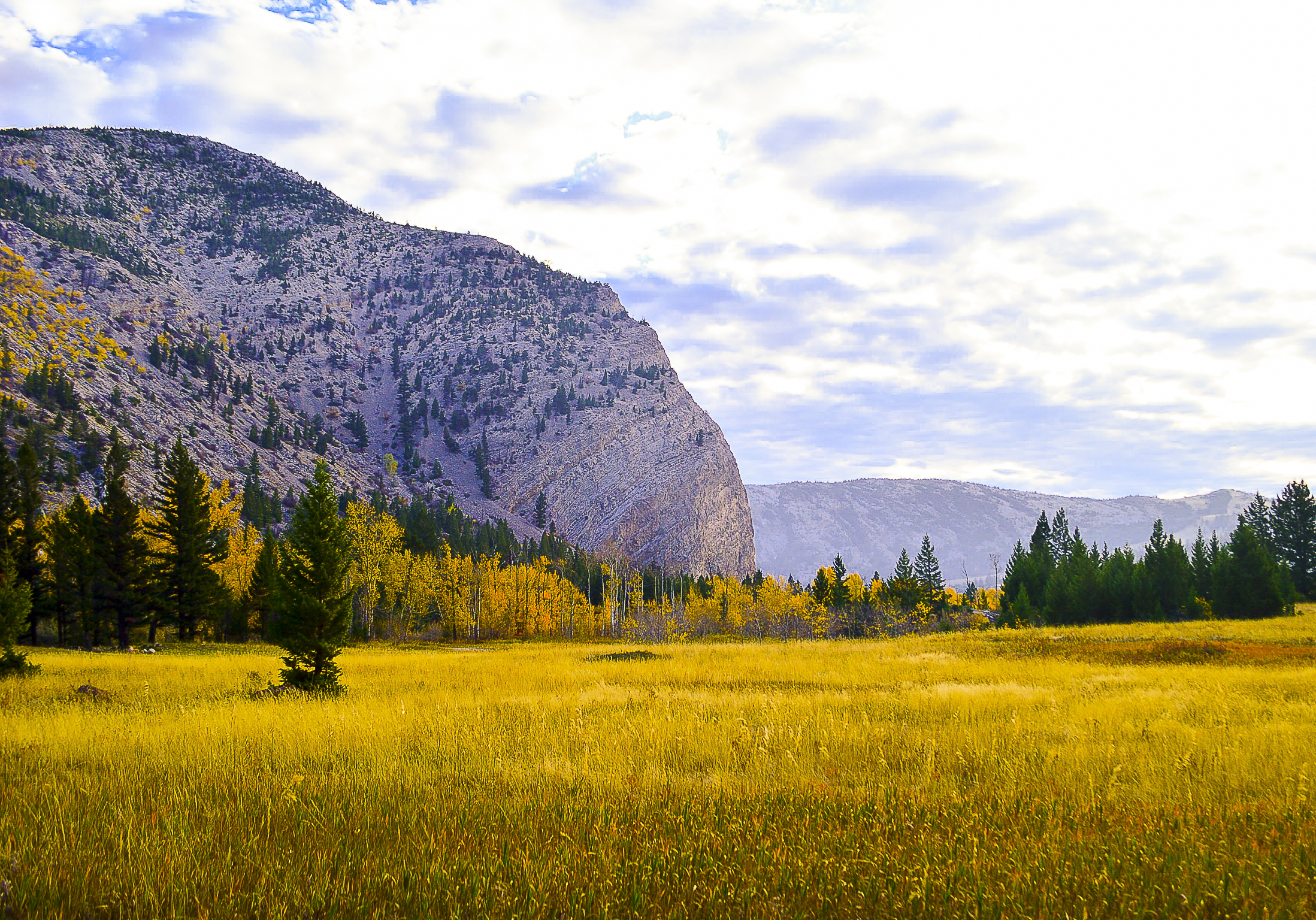
Hannan Gulch
The mouth of Hannan Gulch meets the Sun River near the southwestern edge of Castle Reef, on the eastern front of the Rockies in Montana.

Headwaters
Evening clouds catch the remains of the days sunlight just north of Three Forks, MT, looking toward the confluence of the Gallatin, Madison and Jefferson Rivers, where they merge to form the mighty Missouri River, in south-central MT.

Hyalite in winter
Recent snow blankets Upper Hyalite Canyon in the Gallatin Range of south central MT, on a frigid day.

Middle Thompson Lake
A hazy sunset on its way at Middle Thompson Lake, in northwestern Montana’s Kootenai country, between Kalispell and Libby. Normally clear, the skies are smokey from nearby forest fires.
The chain of glacial kettle lakes are named for Scotsman David Thompson, an early 1800’s explorer and cartographer.
The lakes are home to an incredible variety of fish, including walleye and northern pike, Kokanee salmon, rainbow trout, bass, lake trout, perch and west slope cutthroat trout. The lakes and surrounding area host a virtual who’s who of North American wildlife and birds of prey.

Leadville
Abandoned rail lines lead west toward Mount Massive from Leadville, Colorado. Constructed in the 1880’s, the lines served until the ore ran out.
At 10,152 feet above sea level, Leadville is the highest town in the United States.

Glorious sunset
South of the ranch town of Choteau, Montana, the sun presents a glorious show before disappearing over the eastern front range.
The area shows obvious evidence of the tremendous power of receding glaciers.
Just north, lies Egg Mountain, site of the first dinosaur nest found anywhere in the world.
In more recent times, the grizzly bear and wolves once again roam the plains, as they did once did prior to the settlement of people in the area.
It is home to some of the last relatively untouched prairies of the northern Great Plains. The mountains of Montana’s Front Range remain wild and are prime habitat for wildlife, including the black bear, mountain lion, deer, elk, lynx and wolverine.

Middle Fork
A late October afternoon along the Middlle Fork of the Flathead River, as it winds its way along the southern edge of northwestern Montana’s Glacier National Park.
Immediately to the south lies one of the United States largest intact wild areas, the Bob Marshall-Scapegoat wilderness.

Bird Woman Falls
Visible in the late afternoon shadows, and cascading from the hanging valley formed by the north and west flanks of Mount Oberlin, Bird Woman Falls is actually a series of falls, dropping 960 feet into the valley below.

McDonald Creek
McDonald Creek appears as a silver ribbon at the bases of Mount Cannon and Heavens Peak, in this view looking southwest toward Stanton Mountain and Lake McDonald.

Sunset from the Loop
Sunset highlights the remnants of burned lodgepole pines, seen here looking northwest from the Loop on Glacier National Park’s Going to the Sun Highway.

The Garden Wall
Haystack Butte and Mt. Gould form part of the Garden Wall, a glacial arête on the west side of Glacier National Park, which hangs above the McDonald Valley, separating it from the Many Glacier area to the east.

Swiftcurrent Lake
Swiftcurrent Lake in the Many Glacier Valley of Glacier National Park. Behind are Grinnell Peak, Swiftcurrent Mountain, and Mt. Wilbur.

Grinnell
On the shore of Swiftcurrent Lake, looking southwest toward Grinnell Point and the flanks of Allen Mountain. Looming in the distance are Mt. Gould, the Garden Wall, and Angel Wing.

Clouds on Logan Pass
The awe-inspiring Going to the Sun Highway is a 52 mile engineering marvel bisecting Glacier National Park.
After two decades of construction, over $2 million in costs, and 250 tons of explosives, the highway opened to automobile traffic in 1932.
Partially obscured by clouds, the view from the west side, near Weeping Wall looking toward Mount Oberlin, Clements Mountain and Mount Cannon, with Heavens Peak in the distance.

The Crazy's
The 40 mile long island range of the northern Rockies, the Crazy Mountains, or Crazies, as they are known to the locals.
Situated between the Mussellshell River to the north, Yellowstone River to the south, and the Shields River to the west, the impressive range rises over 7,000 feet above the great plains to the east.

Sand Hollow
Contrasting terrain at Sand Hollow near St. George, Utah.

St. George
The city of St. George, Utah lies in a valley adjacent to the Pine Valley Mountains, near the convergence of three distinct geological areas: the Mojave Desert, the Colorado Plateau, and the Great Basin.
Originally occupied by the Virgin River Anasazi, then later by the Paiute Indians. It was explored by the 1776 European Dominguez-Escalante expedition, then more recently, it was known as a cotton mission, and populated by the Mormon Church under Brigham Young. The town was named for George A. Smith, an apostle of the LDS church.
Today, the city thrives and grows, and is a gateway to nearby Zion National Park.
Seven discrete geological layers contribute to the terrain. The presence of rich amounts of iron oxide lends the brilliant, almost unreal shades of red to the rocks and soil in the region.

Desert clouds
Clouds moving in just northwest of Page, Arizona, along the Colorado River Canyon.

Page
Late afternoon storm-clouds between Page and Kaibito, Arizona, on the Navajo reservation.
Monsoon, a yearly summer phenomena that’s a part of the North American Monsoon, typically occurs between July and mid-September, and is fueled by a combination of a thermal low (a trough of low pressure from intense surface heating), and moisture from the Gulfs of California and Mexico.
This combination builds in the later half of the day, producing late afternoon and evening showers, then clears overnight with surface cooling, and repeats again the next day.
This precipitation provides life for an astounding diversity of plants and animals. It can also cause sudden devastation in the form of flash-floods. It is also responsible for the majority of unique rock formations in the region.

Antelope Pass
Near Bitter Springs, in the monocline known as the Echo Cliffs, a 70 mile section of the Chinle Formation, part of the Colorado Plateau in northern Arizona, east of the Grand Canyon.

Vermillion Cliffs
The Vermillion Cliffs of northern Arizona and southern Utah are the second "step" up in the five-step Grand Staircase of the Colorado Plateau.
Seen here from Antelope Pass, just north of Bitter Springs, the cliffs extend west from near Page, Arizona, for a considerable distance, in both Arizona and Utah.
Made of deposited silt and desert dunes, cemented by infiltrated carbonates, they are colored by iron oxide, giving the intense red, as well as other minerals, particularly bluish manganese.
The cliffs provided navigational aid to early settlers in the region, were explored by Spanish explorers and missionaries, and have been home to native tribes for over 12,000 years.
Marble Canyon, cut by the Colorado River, marks the beginnings of the Grand Canyon, roughly 40 miles to the south.

Storm Castle Peak
One of the more prominent geological features of south-central Montana’s Gallatin Canyon, this iconic limestone monolith catches the late evening sun.

The Gallatin
South-central Montana’s Gallatin River never fails to take your breath away.
I’ve fished this river many times, and never grew tired of it, even when I caught nothing.
Just being here is the reward.

Spanish Peaks
Late day sun highlights the Spanish Peaks in south-central Montana. Part of the Madison Range of the Rockies, and lying between the Gallatin and Madison Rivers, the peaks are crested with 1.6 billion year old gneiss, making them older than the rest of the range. The area is home to the Lee Metcalf-Spanish Peaks Wilderness Area.

Fall on the Gallatin
Late afternoon sun on a fall day in the Gallatin Canyon of south-central Montana.
Seen here from Squaw Creek Bridge, the Gallatin River flows 120 miles north from its source, Gallatin Lake, in the remote northwestern backcountry of Yellowstone National Park, and merges eventually at Three Forks, where it joins the Madison and Jefferson Rivers to form the Missouri River.

Spring in Gallatin Canyon
Bright spring foliage, north of Big Sky, along the Gallatin River.

Pallette Springs
Pallette Springs, a part of Mammoth Hot Springs in northwest Yellowstone National Park.
Limestone bedrock, not common in the rest of Yellowstone, provides the material to form the terraces that this area is noted for.
In winter, the area remains accessible to those willing to brave the weather. Winter daytime temperatures are generally between 0 and 20 degrees, and often fall below -40 degrees.
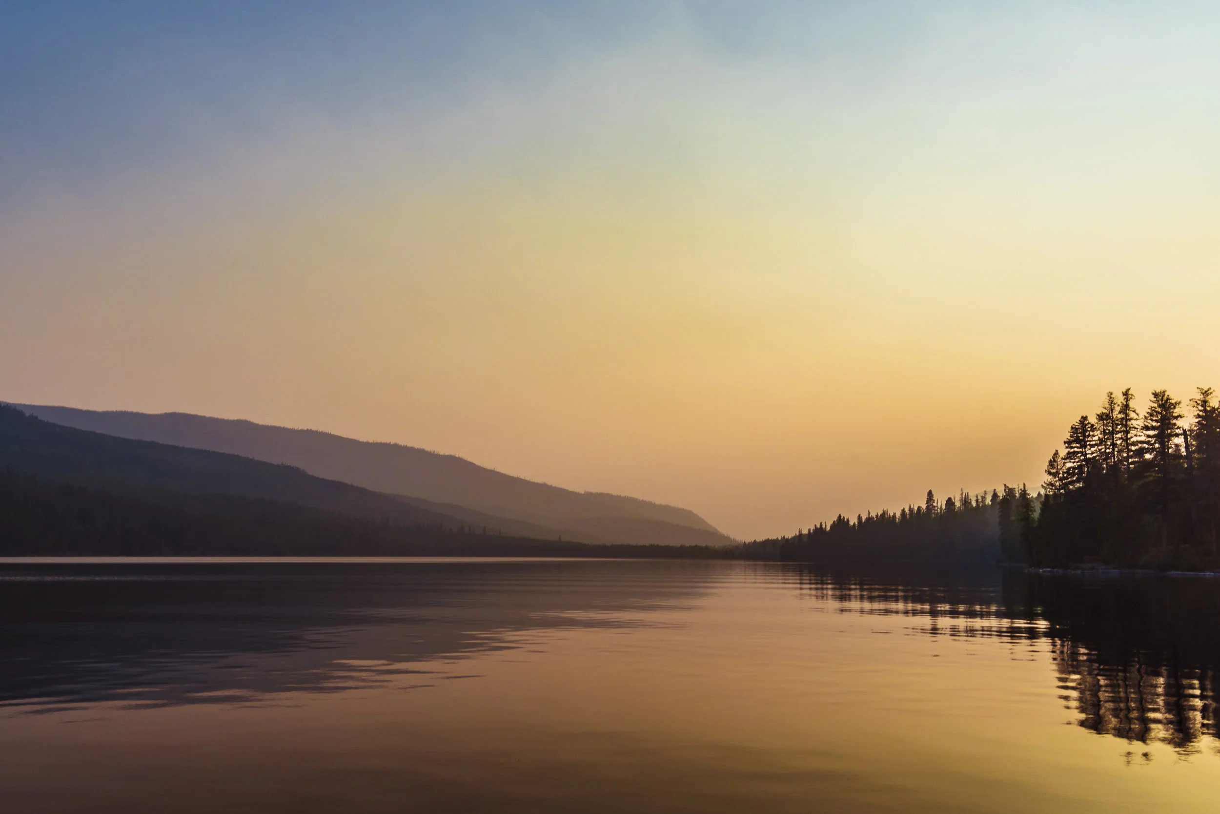
McGregor Lake
A smokey sunset on McGregor Lake, in northwest Montana, a part of the 20-plus lakes forming the Thompson Chain.
Surrounded by the Kootenai National Forest, the spring-fed crystal-clear waters extend 220 feet at the deepest point, and are home to a variety of fish, with Kokanee salmon, rainbow trout, and lake trout, as well as Arctic grayling, yellow perch, brook trout and redside shiner.
Like much of the region, it is also home to a significant variety of woodland mammals.

Sprague Lake
Sprague Lake, in Colorado’s Rocky Mountain National Park, named for Abner Sprague, one of the original settlers in the Estes Park area.
Sprague began building a homestead in Moraine Park in 1874, then later built a guest lodge in the Glacier Basin area, which was once located at the site of the Sprague Lake parking area.

Lake McDonald
Lake McDonald on an uncharacteristically smokey August evening.
At greater than a mile wide, 10 miles long and 472 feet deep, the lake is the largest in Glacier National Park. It is surrounded by dense coniferous forests composed of various species, but dominated by spruce, fir and larch.
Like many of Glacier’s waters, the lake is known for the amazing variety of colors in the rocks and pebbles visible from the surface. Ranging from deep red to maroon, and blue, green and yellow, the rocks are all rubbed smooth by centuries of erosion.

South Cottonwood Creek
Fresh snow blankets South Cottonwood Creek on the southwestern edge of the Gallatin Valley near Bozeman, Montana. Not far downstream, the creek flows in to the Gallatin River.

McDonald Creek and the Garden Wall
The Garden Wall, seen from beside McDonald Creek in western Glacier National Park.

Chico Pond
Located just south east of Montana’s Chico Hot Springs, lies the tranquil spring-fed Trout Pond.
Nestled at the base of 10,926 foot Emigrant Peak in Paradise Valley, the area has attracted visitors for over 120 years.

Haunted by waters...
“Like many fly fishermen in western Montana where the summer days are almost Arctic in length, I often do not start fishing until the cool of the evening. Then in the Arctic half-light of the canyon, all existence fades to a being with my soul and memories and the sounds of the Big Blackfoot River and a four-count rhythm and the hope that a fish will rise.
Eventually, all things merge into one, and a river runs through it. The river was cut by the world's great flood and runs over rocks from the basement of time. On some of those rocks are timeless raindrops. Under the rocks are the words, and some of the words are theirs.
I am haunted by waters.”
― Norman Maclean, A River Runs Through It

Priest Butte
Originally a rail extension branch belonging to the Chicago, Milwaukee, St. Paul and Pacific Railroad (commonly known as the Milwaukee Road), the lines, still in use, lead north from Eastham Junction toward Priest Butte and the farming and ranching community of Choteau. MT.
Named for three Jesuit Priests who founded a Jesuit Mission among the Blackfeet tribe in 1859. The mission was eventually moved to the area west of Cascade, MT, due to the hostility of the Blackfeet at attempts at education and religious conversion.
Choteau began as a trading post called Old Agency, and was named in honor of Pierre Choteau, Jr., president of the American Fur Company, who brought the first steamboat up the Missouri River to Fort Benton.

Storm Castle Creek
Storm Castle Creek flows west from its origin below Divide Peak, eventually becoming a tributary to the Gallatin River not far downstream, in south-central Montana’s Gallatin Range.

Big Timber Creek
Starting high on the steep sought facing slope of Conical Peak in south central Montana’s Crazy Mountains, Big Timber Creek, named by William Clark on the Lewis and Clark Expedition, flows east through a narrow canyon to the plains and south into the Yellowstone River, near the town of Big Timber.
The water is crystal clear, and cold.

Breathe
A mid-March sunset on the front range south of Choteau, Montana. The landscape here looks much as it has for millenia. The Rockies rise nearly perpendicular from the plains, which show clear evidence of the last Ice Age, and the effects of glaciation.

Fairy Creek
Starting high in the Bridger Mountains of south-central Montana, at the east base of Sacagawea Peak, Fairy Creek leaves Fairy Lake dropping over 3,000 feet, as it flows northeast and eventually into Cache Creek, then Flathead Creek, and then south into the Shields River and then into the Yellowstone.

Density
The simple beauty of the forest has a calming effect. This particular forest is located near Pine Creek, in Paradise Valley, Montana.
This well-named valley extends south from Livingston, MT to Yankee Jim Canyon, just north of the northern border of Yellowstone Park, and was carved by the erosive forces of the Yellowstone River. It is flanked by the Absaroka Range to the East and the Gallatin Range to the west. The section of the Yellowstone in this valley is regarded as one the premier fly fishing rivers in the world.

St. Mary Lake and Wild Goose Island
Nearly 10 miles long, and 300 feet deep, St. Mary Lake, in the eastern half of Glacier National Park, is the second largest lake in the park.
The water temperature rarely exceeds 50 degrees F., and is home to various species of trout. The lake often completely freezes over in winter, with ice as thick as four feet.
Wild Goose Island rises a mere 14 feet above the surface, but is one of the most photographed places in the park.

Fire in the Sky
Another stunning sunset graces the high northern plains along the Rocky Mountain Front. This area looks much as it has since native tribes inhabited this land.

Sphinx Mountain Homestead
The remnants of an old homestead in the Madison River Valley, just west of 10,480 foot Sphinx Mountain, in Madison County, Montana.

Two Medicine
Stunning Two Medicine Lake, in southeastern Glacier National Park, is framed by many peaks, including SInopah (center), Mount St. Nicholas, Pumpelly Pillar, and Rising Wolf Mountain.
At two miles long and just over 1/3 mile wide, it is actually one of three lakes in succession: Upper Two Medicine, Two Medicine, and Lower Two Medicine.
This name is reported to have been derived from the name "Two Medicine Lodge Creek," so called because at one time there were two "medicine lodges" located on either side of the creek.
The chalet was originally built in 1914 by the Glacier Park hotel Company, a subsidiary of the Great Northern Railway, as part of the railway's extensive program of visitor services development at Glacier. The chalet group originally featured a complex of rustic style log buildings, which provided dining and lodging facilities. President Franklin D. Roosevelt gave a national radio address from Two Medicine Chalets on August 5, 1934, while visiting Glacier. Overnight lodging at the chalet ended with the onset of World War II, and the other buildings at the site were intentionally burned in 1956, except a cabin and the lodge, which now serves as the Two Medicine Store.
The lake is a gateway to a multitude of back-country trails.

Marble Canyon
Marble Canyon is the section of the Colorado River canyon in northern Arizona extending from Lee’s Ferry to the confluence with the Little Colorado River, which marks the beginning of the Grand Canyon.
The canyon actually contains no marble, and although early explorer John Wesley Powell knew this when he named the canyon, he thought the polished limestone looked like marble. In his words, "The limestone of the canyon is often polished, and makes a beautiful marble. Sometimes the rocks are of many colors - white, gray, pink, and purple, with saffron tints."

Ousel Falls
Located near Big Sky, Montana, lies Ousel Falls, on the south fork of the west fork of the Gallatin River.

Palisade Falls
Palisade Falls drops 80 feet over prehistoric lava beds, in Hyalite Canyon, south of Bozeman, Montana.

Logan Creek
Logan Creek spilling down on its way to Oberlin Falls, with Reynolds Mountain rising above Logan Pass in the background.

Gallatin Rainbow
A late mid-June evening rain storm clears with double rainbows at the confluence of the West Gallatin and Gallatin Rivers, at Big Sky Canyon, in south-central Montana.

Beaver Creek
Eight miles north of West Yellowstone, Montana, Beaver Creek flows south and empties into the Madison River and the head of Quake Lake.
The lake was formed overnight on August 17, 1959, when a 7.5 magnitude earthquake struck, causing a 80-million ton landslide that blocked the flow of the river, forming a 180 foot deep, 6 mile long lake.
The massive landslide traveled down the south flank of Sheep Mountain at over 100 miles per hour, killing 28 people camped in the valley.
Upstream a short distance, the bottom of Hebgen Lake dropped 10-20 feet in an area covering 32,000 acres.
The quake was the largest recorded seismic activity in Montana in recorded history. 60 years later, the skeletons of pine trees still rise from the water around the shores of the lake.
Today, the area is peaceful and beautiful, belying the incredible forces at work underground both here and in nearby Yellowstone National Park. History shows us that that another major event is an inevitability.

Gallatin in winter
A frosty late afternoon on south-central Montana’s Gallatin River, north of Yellowstone Park.

Fall of the Jefferson
A warm fall day on south central Montana’s Jefferson River, just north of Milligan Creek, with the Bridger Mountains in the background.
Just 8 miles north, the Jefferson merges with the Madison and Gallatin Rivers near Three Forks, forming the Missouri River.

Eddie
Some people are in our lives for a flash, and we never even realize the reason why. Others are there for eternity, and we intuitively know from the very beginning that they will serve a higher purpose in our lives.
This dock lies on the surface of the crystal clear waters of Seeley Lake, Montana. It’s hard to find a place closer to God.
And fittingly, it is also the final resting place of one of my very best friends, Ed Dea.
We shared some of the best, and very worst days that life has to offer.
He was a good man.
RIP, brother.
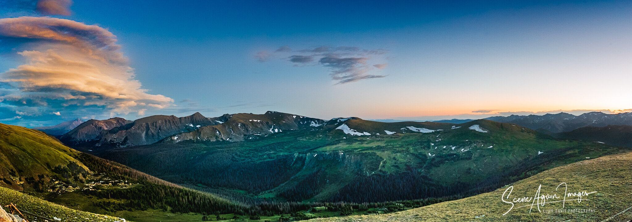
Gore Range - Rocky Mountain National Park
A stitched panorama taken on a beautiful summer evening at 12,048 ft. elevation. at the Gore Range overlook in north Colorado's Rocky Mountain National Park. From this location above timberline and in the tundra, one can see sweeping views of the Gore Range, Rocky Mountain National Parks tallest peaks, and the Never Summer Mountains.

South St. Vrain Creek: Indian Peaks Wilderness
South St. Vrain Creek, as it begins its journey east from Isabelle Lake, on the Pawnee Pass Trail. Located in the north central Colorado Rockies, and bordering Rocky Mountain National Park to the south, the Indian Peaks Wilderness takes its name from the surrounding peaks named for indigenous tribes, including Navajo, Apache and Shoshone Peaks, which form the glacial cirque holding Isabelle Lake and glacier. This view show the impressive Niwot Ridge, a UNESCO designated Biosphere Reserve. The location sits at the transition from pine forest and prime riparian zone moose habitat, to subalpine and alpine tundra zones.

End of day at the dunes.
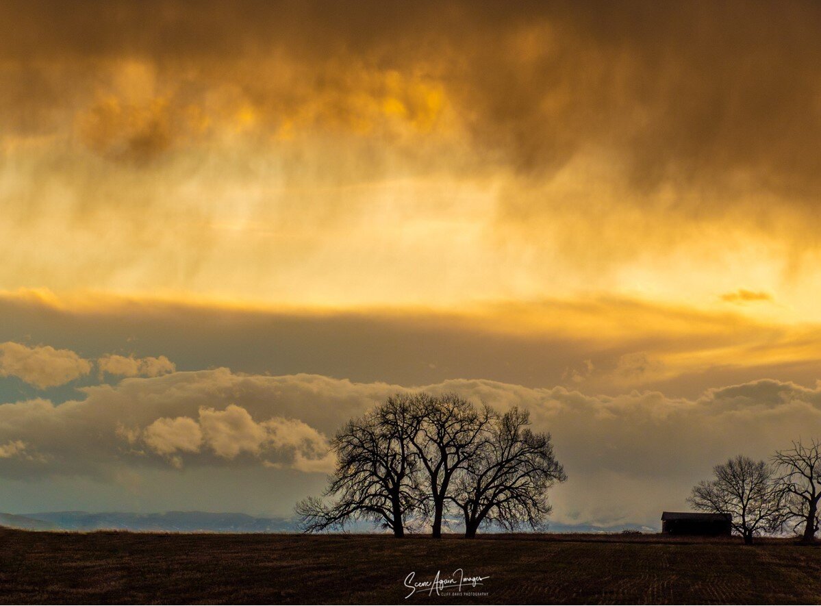
Storm at sunset
The soon to set sun, with a storm approaching, silhouettes a tree amd old farm bulding near Frederick, Colorado.
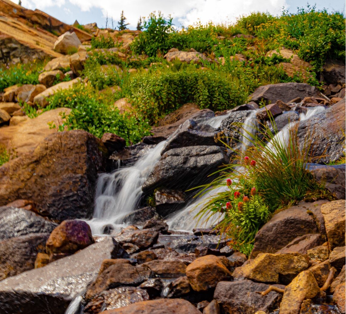
St. Vrain Creek
Growing up in Montana, rivers, lakes and streams were abundant.
Since I can remember, the sound and feel of flowing water has been a calming and centering force from the turbulence of life.
I’ve spent many hours fly fishing on rivers and streams, but my favorites are mountain streams, where I can lose myself in the stillness and beauty, and forget about the rest of the world.
This hike to Lake Isabelle in the Indian Peaks Wilderness was both a getaway; and a chance to find some isolation and experience the beauty of the Colorado Rockies, and to take away something to share with others.
Nestled directly under the Continental Divide at 10,500 feet, Lake Isabelle is fed by runoff from winter snow, as well as the slow decline of Isabelle glacier.
From there, the water flows east as South St. Vrain Creek, on its journey to the Gulf of Mexico and the Atlantic.
I had intended to hike directly to the lake, but couldn’t pass up an opportunity to relax in the surroundings, with the sound of flowing water, surrounding mountains views, and beautiful wildflowers.

Late day in Wolf Creek Canyon
Roughly midway between the towns of Craig and Cascade in central Montana, lies DeLacey Point.
Driving above on southbound Interstate 15, one might miss it in a blink - if they weren’t paying close enough attention. Yet another sharp turn in the river that the interstate loosely follows.
Before there was an interstate here, with traffic moving by at a blurring 80 mph, there was the land, and the people and animals that inhabited it.
And before everything else, there were the rocks.
The exposed rock in this canyon, including this point, was formed from ancient seabed shale in pale hues of rose and green, laid down in the Precambrian Era.
The rocks here are from the basement of time; an amazing 1.4 billion years old.
About 70 million years ago, these core rocks were crumpled, folded, and faulted during the formation of the Rocky Mountains by tectonic plate migration and subduction. Later, during the ice age of the Pleistocene Epoch, the ravages of glaciation along with the recession of these massive glaciers, as well as millennia of erosion, and the effects of the river, further shaped what we see today.
The area was at one time part of the territory of the Blackfeet tribe who fiercely protected their lands, often killing unwelcome intruders.
The point was named for Captain Walter DeLacey, a surveyor, cartographer, civil engineer and West Point graduate, who was commissioned by the Montana Territorial Legislature to produce a map of the Territory during its first meeting in the summer of 1864, following the formation of the Territory on May 16, 1864.
The area is commonly known as Mountain Palace, and is easily viewed from a long curve in Old US Highway 91, bordered on one side by steep cliffs that occasionally release rock to fall on the roadway below, and the Mighty Missouri River on the other.
Here the river and highway snake through the stunning Wolf Creek Canyon -also known as the Prickly Pear Canyon - located in the Big Belt Mountains, a side chain of the Rockies.
Built on the route of an ancient Indian trail, the road was initially constructed as a toll road in 1865 by the Little Prickly Pear Wagon Road Company, allowing goods from the East to travel by paddleboat up the navigable portion of the Missouri River to Fort Benton, and then by freight wagon south to the soon to be territorial capital city of Helena. The road was later purchased and improved and it remained the primary northern freight route into Helena until the coming of the railroads in the 1880s. In 1887, the Montana Central Railway laid tracks through the canyon, which remain, unused since 2000.
The point lies less than a mile upstream from the 90 year old, three-span, two-lane Hardy Bridge over the Missouri River. I can recall in years past, driving over the old wood surface, with a clickety-clack sound known only to those who’ve driven a similar bridge. Now, it’s a paved surface, but it hasn’t lost the feel one gets driving slowly over it, and the journey back in time it conjures in the mind.
It’s the same bridge that has seen people on foot, horseback, in horse-drawn wagons and buggies, Model A’s and T’s, steam and diesel tractors, and present day cars and trucks.
The Mountain Palace Tavern, is a log structure built in 1936, across the Missouri River. During the time period when U.S. Highway 91 served as the main travel way along the Missouri River, Mountain Palace Tavern provided rest, food, and a break for travelers between Great Falls and Helena.
Today, the point is seen by fly-fishermen floating in drift boats or wade-fishing this section of the blue-ribbon trout river, as well as by day-ride sightseers, and the locals. It’s not uncommon to see deer, elk and even bighorn sheep nearby.
First seen by white men early in the summer of 1805, on the westward leg of the Lewis and Clark Expedition, it’s easy to feel like you’ve stepped back in time here - like you are the very first to lay on eyes on the area. Like at any moment, you’ll see a few native warriors on horses ride over the saddle in front of you, or catch a glimpse of a steam train train carrying passengers from Helena to Great Falls as it exits the tunnel entrance invisible in this photo. At one time, my great-grandfather rode these very same rails.
In my younger years, particularly following the tragic death of my older brother, I spent time driving, walking, fly-fishing and taking in the canyon, finding peace and solace there, and at times, feeling as if I was the first one to see the magnificence of the canyon. The world shrank to an existence of me, the rocks, the ever changing sky, the river, and the trout, in glorious isolation from the troubles and worries of the outside world.
Later, after I had traveled, I was struck by the amazing similarity of parts of the canyon to the Scottish Highlands; and the differences as well.
I’m quite sure this view has changed little in millions of years, save the effects of the river, weather, man, and the march of time.
And so it was, on this warm, beautiful evening in early October, the view - billions of years in the making - was sublime, and we were treated to an amazing interaction of the land, water, and the Big Sky.

The Dunes
Great Sand Dunes National Park in sought central Colorado is an anomaly. Covering an area of about 30 square miles, and containing an estimated 1.2 cubic miles of sand, the park contains the tallest sand dunes in North America, with some as high as 750 feet. These dunes are packed into the eastern flank of the San Luis Valley, at the western base of the Sangre de Cristo range.
Over eons, sediment from surrounding mountains was carried into the valley as part of an ancient lake, After the lake receded, the exposed sand was blown by predominantly southwest winds to the base of the mountains over tens of thousands of years, forming the dunes present today.
In later times, the area was inhabited by the Southern Ute tribe, as well as the Apache and Navajo.
Today the national park encompasses not only the dunes, but riparian zones, montane woodlands, subalpine forest and alpine tundra in the Sagre de Cristos, which tower above the valley over 14,000 feet.

Last light of day at the dunes
Great Sand Dunes National Park in sought central Colorado is an anomaly. Covering an area of about 30 square miles, and containing an estimated 1.2 cubic miles of sand, the park contains the tallest sand dunes in North America, with some as high as 750 feet. These dunes are packed into the eastern flank of the San Luis Valley, at the western base of the Sangre de Cristo range.
Over eons, sediment from surrounding mountains was carried into the valley as part of an ancient lake, After the lake receded, the exposed sand was blown by predominantly southwest winds to the base of the mountains over tens of thousands of years, forming the dunes present today.
In later times, the area was inhabited by the Southern Ute tribe, as well as the Apache and Navajo.
Today the national park encompasses not only the dunes, but riparian zones, montane woodlands, subalpine forest and alpine tundra in the Sagre de Cristos, which tower above the valley over 14,000 feet.

Dream Lake
Late evening light at Dream Lake in north Colorado’s Rocky Mountain National Park. Sitting at 9,905 feet ASL, the lake rests in a high alpine valley.

Hebgen Lake, Grayling Arm
Just east of Yellowstone National Park, lies Hebgen Lake. Actually a reservoir created by Hebgen Dam, is located in a high basin in south west Montana. Well-known for its excellent fishing the lake is popular for boating, water-skiing, kayaking and sailing as well.

Winter Dream
Sunset at 12,720 foot Hallett Peak, looming over Dream Lake in north Colorado’s Rocky Mountain National Park. Sitting at 9,905 feet ASL, the lake rests in a high alpine valley accessible by trail which is snow-packed and icy in winter.
The lake freezes in winter and is usually snow-covered, but it often blown clear by high-mountain winds, revealing the mirror-like blue ice. As the ice warms and cools during sunny winter days, it expands and contracts. The result is tension and compression in the ice sheet, forming cracks in the upper surface of the ice.

Fall on Boreas Pass
Autumn storms moving toward central Colorado’s 11,481 foot Boreas Pass, on the Continental Divide south of Breckenridge.
Originally known as Breckenridge Pass in the 1860’s, it served as an early route for prospectors crossing from South Park, north to Breckenridge. It was later widened to accommodate stage coaches, then in 1882, the Denver, South Park and Pacific Railroad built a narrow-gauge line and renamed it Boreas Pass after the ancient Greek god of the north wind.
Remains of a roundhouse, a water tower, and the ghost town of Boreas can still be seen along the route, along with many abandoned mining sites. The line was abandoned in 1937, and after World War 2, the Army Corp of Engineers rebuilt the route for automobiles.
This view is from near the pass looking west into the Mosquito Range.

Dawn on the Jefferson
The winter sun beginning its rise behind the Bridger Range and the Jefferson River, just outside of Three Forks, Montana.

Sun River Canyon
I drove in the early morning hours before daylight. From my home city of Great Falls, I headed west about 45 miles, paralleling the Sun River, then northwest to Augusta, with a quick left turn in the pre-dawn, while everyone else slept.
Driving west, I crossed the remaining stretch of the great Northern Prairie and ranches, where the land quickly begins to change.
The terrain rises steeply to the west, with the land abruptly rising three to four-thousand feet of elevation in less than a few miles. On a clear day, it’s visible for more than 80 miles to the east.
The rocks here were one day located near the current western Idaho border. A billion years ago, during the Precambrian era, mudstone, sandstone and limestone that once sat at the base of shallow waters was lifted and pushed eastward abruptly in an overthrust, forming the Sawtooth range and the eastern edge of the Rocky Mountains.
The results of this ancient tectonic activity rose directly in front of me, looming larger as I approached.
There, the road rejoins the Sun River, with the brief foothills on the south to the left of me. I rounded one more curve, and entered the 20 mile long Sun River Canyon.
The river starts deep in the mountains ahead, actually the combination of the north and south forks of the Sun, which merge to the west, then cut through the steep parallel ridges formed of carbonate, and exit the Rockies here.
Along with a change in terrain, there is a change in vegetation, no longer the scrub brush and prairie grasses. At this point it is conifers and aspens, with the aspens now the gold-yellow of autumn, with some having already dropped their leaves.
This area is wild, perhaps wilder than any area in the continental United States. The Lewis and Clark National Forest begins here, and seamlessly melds into the vast Bob Marshall wilderness, extending over the Continental Divide to the Seeley and Swan Valleys, and north to Glacier National Park.
This pristine land remains much the same as it has been since before the arrival of humans.
Elk, deer, moose, coyotes, wolves, mountain lions, black bear and grizzlies call this place home. In less than a month, one of the largest herds of Bighorn Sheep, numbering 800-1000, will converge here as they do every year in the spring and fall.
Further into the canyon, I arrive at the head of Hannan Gulch, a place that holds great significance to me.
In early June 1987, I was working as a medic on Mercy Flight, a medevac helicopter based in Great Falls, Montana. A call from a friend - a Glacier Park ranger - convinced me to trade my scheduled shift, and attend a mountain rescue course at Many Glacier Valley to the north.
I attended and gave my part of the safety training, and after that, we all went to a barbecue. Later, the crew left on their return to Great Falls. Several hours later, I received a phone call inquiring as to the location of the helicopter and crew. They had not made it back. We searched Many Glacier Valley that evening, and a massive search ensued over the next several days, with no trace of them being found until April 9, when a military helicopter sighted crash wreckage at the head of Hannan Gulch. All aboard had perished.
Memories of that day and the days following came flooding back as I gazed up the gulch. Feelings of sorrow, sadness and survivors guilt had lessened in the intervening years, and those remaining laid below the surface, until my presence here caused some to resurface.
I continued upstream to Gibson reservoir, spent some time there, then headed back down the canyon, stopping for this view.
By now the sun was making its presence known, as light spilled over the plains, pouring through the few east-west breaks in the front, lighting up this gulch and illuminating the rising morning fog.
I remained here, watching the sun rise, feeling alive and grateful to be in this stunning, wild, epic landscape; thankful to be alive and surrounded by life.

The Front
The always impressive view of the northern Rocky Mountain Front, looking north west from south of Augusta.


The fishpond sits just up the mountain behind Chico Hot Springs, in South Central Montana’s aptly named Paradise Valley.
